ROADS ACCESS CONFUSION IS JUST SIGN OF THE TIMES

THE CHARM OF CHARN: Looking to the distinctive shapes of Ben Nevis and the Aonachs from the summit of the Corbett Geal Charn

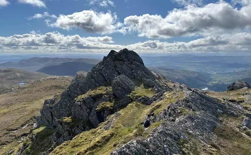
TEE-TIME: Ben Tee, right, above gorge
TWO grand days in the west where the superb conditions made mountain navigation simple. Pity the same couldn't be said for the roads up the glens.
It feels like everywhere is under siege at the moment in the great energy rush. Work on run-of-river and pumped hydro storage schemes plus the transport and erection of giant wind turbines mean that narrow access roads and bridges need to be widened and strengthened to cope with the heavy-duty traffic.
Walkers heading for the Glen Garry Munros should be aware that there are timed restrictions in place along the Kinloch Hourn road. It's a similar situation for those planning a trip to the mountains from Loch Arkaig, with road closures on certain days and times. It should all be easy enough to check, but as those who regularly tramp the heights know only too well, clarity in any form is a valued but rare commodity.
A few weeks ago, there were closure signs liberally sprinkled around the road network at Coupar Angus and Blairgowrie for water works. It turned out that each one was for a different day but it was obviously easier to leave them up for the duration rather than putting them out at the relevant times. The result was a lot of frustration and unnecessary detours.
Now I had come to a screeching halt beside the Eas Chia-aig waterfalls where a plethora of conflicting signs were spread across the Arkaig road. I was only needing to travel a couple of miles beyond this point to Achnasaul for the start of a horseshoe circuit of the Corbetts Meall na h-Eilde and Geal Charn. Instead, I was faced with:
Road closed to all vehicles.
Road closed at Bridge No.4.
Road closed from 9am Tues to 5pm Thursday for next four weeks.
This was Wednesday and as you can see there was plenty of choice but little consensus. I wondered if they had employed Kenny Dalglish to organise the signage.
Road closed: Mibees aye, mibees naw.
With no definitive instruction, I decided to take my chances and continue on. There were other vehicles coming in and out, including postal and delivery vans, and there obviously had to be access for residents of the glen and those going to their boats and caravans. As I headed uphill under a blue sky and a brilliant sun, Loch Arkaig lay buried under a low mist. Somewhere under that blanket there were road works, but I never encountered any obstructions going in or when I came down nearly six hours later.
The hydro track I was using soon gave way to a very wet and muddy hill path in the shadow of Glas Bheinn followed by a pathless and even wetter trek round towards the foot of Meall na h-Eilde. The recent settled weather didn't seem to have made much of a dent in ground conditions. The steep ascent meant it did get drier for a bit, but the relief at reaching a levelling on the ridge soon dissipated at the sight of a stretch of peat bog and marsh still to be crossed. I do love sphagnum moss, but sometimes there's a limit.
The whole bogs and roads combo had induced a groundhog day feel. The chosen mountain the previous day had been Ben Tee, a beautiful conical presence above Loch Lochy which makes it stand out from the crowd. The starting point at Kilfinnan is reached by a narrow rollercoaster road for 2.5 miles along the west side of the loch. This is also one of the access points for construction traffic servicing the Coire Glas pumped hydro storage scheme further down the glen and it's fair to say the road surface isn't faring too well.
Once again, signs were everywhere, though to be fair not all of them are to do with the hydro scheme. Apart from the regular heavy vehicles warnings, there are signs for (in no particular order of importance) chickens, children, eggs, a pub, a steep drop over a wall and a reminder that any damage to a boundary wall would have to be paid for. In the case of the last two, it would appear the biggest chance of an accident would actually be trying to read the signs while driving, but hey-ho.
The bog trot began almost immediately. It was muddy heading up the side of the gorge and even gloopier along top of it. Then it turned into a quagmire on the more level section. You would think it couldn't get worse, but then I came to a sign:
Caution: Soft ground.
This was the result of investigative work for the Coire Glas scheme further upstream, and the ground had since been reinstated. But considering this was a hillside in Scotland where flippers would often be more appropriate for most of the year, I started to wonder just how bad this could be.
Quicksand came to mind, a somewhat irrational fear which seems to be shared by many, although I've yet to meet anyone who has actually encountered it in the real world. Still, I could envisage sinking slowly with every step forward until there was nothing but a bobble hat visible on the surface. Another victim of not believing the signs.
Give them their due, it was impressive on the scale of softness, but a bit of leaping from stone to stone got me over. And being an out and back hill I had to do it all over again in reverse.
Perhaps if they took down the signs and laid them end to end like a boardwalk, it would make the bog crossing a lot easier. Just a thought.