DROVERS' ROAD PROVIDES QUIET BACKDOOR ROUTE TO GLAS MAOL MUNROS

THE WAY AHEAD: Sign pointing to the start of the Monega Path with the impressive faces of Caenlochan in distance

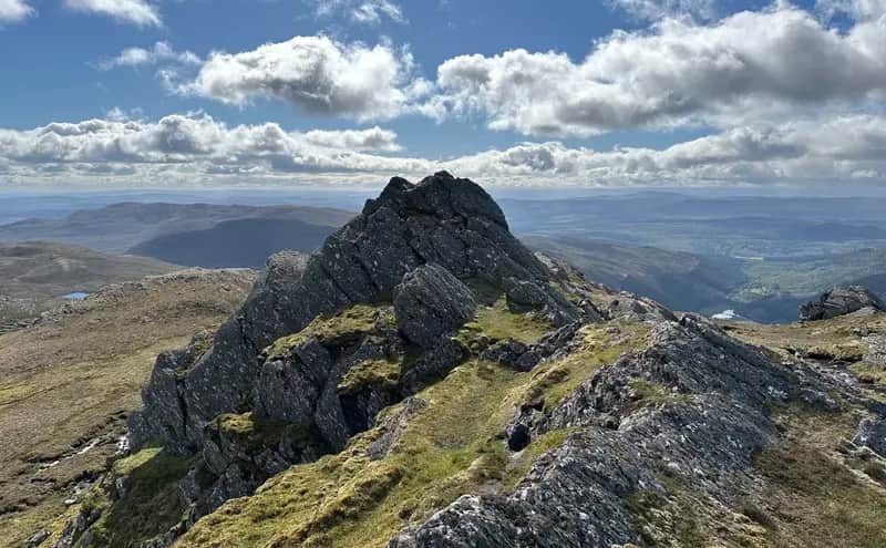
CRAGFEST: Druim Mor
IT'S easy to understand why so many choose to tackle the pairing of Glas Maol and Creag Leacach from the Glenshee approach.
The high elevation makes for an easy day for families, mountain novices or anyone with time constraints, but it's also a handy springboard for those with eyes on a round of six or even nine Munros.
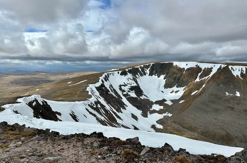
The trade-off is that aesthetically it's a fairly soulless experience, a plod up bulldozed tracks among the ski centre detritus from a busy car park. The winter snows bring some improvement, but not much.
That lack of inspiration is an accusation often levelled at mountains of the eastern Highlands, but take time to look behind the trade route facades and you will find a wilder side to these sprawling hills. The mountainous terrain known as The Mounth is crisscrossed by a series of cattle drovers' routes, historic rights of way that carve their way through the contours.
The Monega Path is the highest of these old roads, reaching a height of over 1000 metres close to the summit of Glas Maol. It crosses featureless and exposed ground, and when winter storms are raging and the line of the path is buried, it is a serious undertaking. This is perhaps why it was a less popular route to Braemar than the almost parallel Tolmounth, and in turn, why it was said to be favoured by smugglers. Queen Victoria also travelled it in 1861, just two months before the death of Prince Albert.
Glen Isla has a serene ambience: silence apart from birdsong and the whisper of water at the road-end at Auchavan, just two parked cars plus two campers packing up, leaving no trace. Butterflies flitted around the wildflowers at the river banks.
A track heads north by the River Isla for six kilometres, until splitting in a Y-shape at a ruin; Caenlochan Glen is on the left and Canness Glen to the right, while a path heads straight on to wind steeply up a break in the wall ahead to the plateau. En route it passes Bessie's Cairn, a substantial stone construction with seats on all four sides, built in 1852 in honour of a minor aristocrat who loved the area, Lady Elizabeth Londonderry.
This part of the country is of special interest to botanists on account of its mountain flora, and the enclosed Caenlochan Glen is a protected area. Ledges on these precipitous faces are one of the last refuges of the Alpine blue-sow-thistle, and the likes of Alpine gentian, Alpine fleabane, cyphel, scurvy grass and little mouse ear can also be found nearby. The only other walker I had met that morning had been heading up to the innocuous lump of Meikle Kilrannoch in the hope of seeing the extremely rare Alpine catchfly.
I didn't venture that far up the floor of the glen, instead breaking off earlier to climb steadily up the grassy ramp of Monega Hill, following in the footsteps of the cattlemen. There were no cattle but there was plentiful signs of mole activity, and every few steps I would spot something scurrying across the path beneath my feet, shrews or mice perhaps.
From the high point on the hill, the way curves towards Little Glas Maol, but following the cliff edge provides the spectacle of spiralling drops into the depths of Caenlochan Glen, and the craggy face of Druim Mor. This is a summit with a completely flipped personality, its charms well masked during the tedious plod across the plateau from the north, west or east. Witnessing the snow-laden faces of this amphitheatre in winter would be well worth an admission fee.
As I began the short pull to Glas Maol, I parted company with the Monega Path. It contours off to the right to the remains of the county boundary fence and the meeting of three council areas, Angus, Perth and Kinross and Aberdeenshire, before dropping past the minor summit of Sron na Gaoithe and down into Glen Clunie.
The faint sound of voices, the glimpse of figures on the skyline, confirmed I wasn't too far from the spreadeagled cairn on the spacious summit dome, but the shared space was fleeting, and the walk over to Creag Leacach surprisingly quiet. I even had the summit rocks to myself for ten minutes but then decided to move on before my luck ran out.
The hordes of dashing hares which had been providing entertainment during the lunch break stuck with me over the next turn on the circuit to the twin cairns of Carn Ait and again for the more featureless walk over spongy ground to Mallrenheskein, a fairy tale name which seems wasted on such a benign lump.
The rise to Black Hill was over stretches of peat bog, but the recent dry spell made the walking quite pleasant. A sharp left was needed when the fence line ended, another reminder that this could be a more confusing moment in thick weather.
On the final push up the heather slopes of Monamenach, where only the faintest path could be found, I turned to admire the view – ie. take a breather – and found the landscape had largely vanished, drifting curtains of grey reducing visibility of the hills to ghostly shapes. Curiously, it stayed at arms' length and I stayed dry, and by the time the summit cairn was reached full 360 degree vision had been restored.
The last time I had been on this Corbett the snow was waist deep in places, and when I got down I found the car had sunk into the melting pack. It took almost as long to dig it out than it had to get up and down the hill. This time I blasted down in half an hour, and there was no digging to be done.
There were a few more cars parked but the silence was still in situ. This backdoor circuit to two popular Munros with an added Corbett seems to inspire a quiet reverence.